Showing posts with label Silver Spring. Show all posts

Monday, November 10, 2014

Downtown Silver Spring's Upcoming Wave of Development

Development boom poised to be biggest since the 1960's


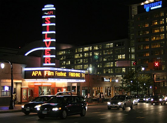
Skyline of Downtown Silver Spring in 2012
Photo Credit: Dan Reed via flickr
UPDATED 09/16

With the completion of Fenwick Station this past July and the upcoming delivery of the Residences at Thayer this fall, the current wave of building construction in downtown Silver Spring is now tapering to an end (the publicly-funded library and transit center projects are exceptions). The lull in development will be short-lived however, as downtown Silver Spring is on the verge of seeing yet another development boom in the coming years. This next wave of construction is poised to be even bigger than the last wave, which was already the urban hub's largest in nearly half a century.

A History of Development in Downtown Silver Spring
Silver Spring was originally 'founded' in 1840 when Francis Preston Blair and his daughter discovered a spring flowing with chips of mica on land just north of the Washington D.C. border. Blair later purchased the land surrounding the spring to create a summer estate which he named "Silver Spring." 

By the early 1900's Silver Spring had begun to grow into a small suburban town on the B&O Railroad's Metropolitan Branch. During the 1960's, the growing commercial hub experienced it's first high-rise construction boom, along with other lower county communities. Between 1961 and 1971 an impressive 23 high-rise buildings were constructed in downtown Silver Spring. However, following the boom was a long dearth of building activity, and the downtown area entered into a period of economic decline from the mid-1970's onward. Even the arrival of Metro's Red Line in Downtown in 1978 did little to rejuvenate the area. 

Downtown Silver Spring didn't really see any significant construction activity again until the arrival of the National Oceanographic and Atmospheric Administration (NOAA) headquarters in the late 1980's and early 1990's. NOAA's massive complex along East-West Highway added four high-rise office buildings to the urban center's skyline, including two of its tallest buildings. Despite the economic boost brought by the NOAA headquarters, the development lull in downtown Silver Spring continued throughout the 1990's.


The center of Downtown Silver Spring
The Beginning of a Renaissance
At the beginning of the 21st century, signs of new life began to emerge in downtown Silver Spring. Several city blocks near the decades-old City Place Mall were completely demolished to accommodate a new 440,000 sq. ft. outdoor retail/entertainment center. In 2003, Discovery Communications completed construction of its new headquarters in the center of the business district, a move the really accelerated Silver Spring's resurgence. Between 2001 and 2010, nearly 15 new high-rise buildings were constructed in Silver Spring compared to the 6 built during the previous decade .

In addition to the surge of private investment, heavy public investment from Montgomery County, as well as the nationwide 'back to the city' movement, also played major roles in Silver Spring's rejuvenation. However, with the still depressed office market, nearly all of the new development in downtown Silver Spring has been residential (with retail components). Between May 2013 and July 2014 an unprecedented six residential apartment buildings (the same total number of buildings completed over the entire decade of the 1990's!) were completed in Silver Spring.

*Newly constructed buildings of 5 or more stories. Does not include conversions of existing buildings (e.g. office to residential)

The Next Wave
As huge as the recent development blitz has been, the upcoming wave could likely surpass it, and possibly the massive 1960's boom. There are over 20 planned or approved high-density projects currently in the pipeline for downtown Silver Spring, with 12 buildings projected to be completed by 2018. 

Below you can find detailed information on every development project currently in the works for downtown Silver Spring:

*Remember to check my comprehensive Urban Development Map for more details on these development projects as well as every project completed since 2005 in Downtown Silver Spring. 

Wednesday, February 5, 2014

The Mid-Atlantic's Most "Exciting" Suburbs

Downtown Silver Spring, MD at night
Photo Credit: UrbanTurf DC
Yesterday, real estate website Movoto released its ranking of the "Most Exciting Suburbs In America." Movoto created its ranking by selecting the 139 largest suburbs (using Census data)
and averaging their ranking over the following 6 criteria:
  • Nightlife per capita (bars, clubs, comedy, etc.)
  • Live music venues per capita
  • Active life options per capita (parks, outdoor activities, etc.)
  • Fast Food restaurants per capita (the fewer the better)
  • Percentage of restaurants that are fast food (the lower the better)
A number of suburbs in the Mid-Atlantic made the top 50 ranking, although none of them made the top 10. The region also seems to be a little underrepresented on the top 50 as well with only with only five suburbs ranked (16% of US population should equal exactly 8 on the list)

The #1 ranked suburb in the nation, Cambridge, MA, isn't really a surprise, neither are a few of the others in the top 10 such as Berkeley, CA and Santa Monica, CA. Some of the other top 10 suburbs however, might cause a few raised eyebrows.  It should come as no surprise though that many suburbs on the list are college towns including the Mid-Atlantic's "most exciting": Towson, MD.

Continue reading to see the national top 10 "most exciting" suburbs ranking as well as the most exciting suburbs here in the Mid-Atlantic.


Wednesday, November 27, 2013

Montgomery County thinks urban...except when it comes to banks

M&T Bank in Downtown Silver Spring
Image Courtesy of Adam Fagen
This article one part of a multi-segment series titled The Urban Transformation, which takes a look at how certain public institutions and private businesses are adapting to nascent urban environments

Montgomery County, MD probably utilizes more new urbanist, smart growth principles in development planning than pretty much every other jurisdiction in the DC Metro region (outside of Washington D.C. itself), and more so than most suburban counties in the nation. However, while new walkable, transit-oriented urban centers in the county have been rapidly growing over the past decade or so with the construction of new high-density, mixed-use development built along these principles, it seems that one type of business has stubbornly resisted the urban transformation: bank branches.

The typical template for mixed-use development in Montgomery County's urban centers comprises either residential units or commercial office space (relatively rare in these days of high vacancy rates across the Metro area and limited government and business expansion) above ground-floor retail in mid- or high-rise buildings. When I use the term "retail" I'm encompassing a wide range of businesses such as: restaurants, nightclubs, barbers, supermarkets, pharmacies, bars, bank branches, etc. The combination of uses in these mixed-use developments is crucial to creating a true urban environment where residents can live, work, shop, and play, and the streets are active from dawn well into the night.

For some reason, banks (in Montgomery County's urban areas) have shied away from this type of development, while pretty much every other form of "retail" has embraced it. There are a number of new bank branches popping up in the county's urban areas, but many as traditional stand-alone single-story buildings with parking, rather than on the ground-floor of multi-story buildings. Some of these locations are pretty high-profile and on very valuable plots of land. 

Thursday, February 28, 2013

Washington's Skyscrapers: The Tallest Buildings in the DC Metro Area

Updated 08/02/13

Washington D.C. is well-known for its uniform skyline of buildings all built up to around the same height, with the few exceptions being a handful of famous monuments and the U.S. Capitol. The main reason that DC (which currently has a population of over 600,000 residents), doesn't have a towering skyline  like other major cities such as New York or San Francisco is the Heights of Buildings Act of 1910

The 1910 Act is the most recent of a series of height restrictions, the first of which was put into law by D.C. Commissioners in 1894 in response to DC's first residential "skyscraper," the 14-story/164 ft. Cairo Hotel (now a condominium building known simply as "The Cairo"). The 1910 Act passed by Congress, which is still in force today, states that maximum height for buildings in DC is 90 feet (27 m) on residential streets, 130 feet (40 m) on commercial streets, and 160 feet (49 m) on a small portion of Pennsylvania Ave.
The Cairo, DC's first "skyscraper"
Over the past decade or so (most recently in 2012) there have been numerous attempts to remove or relax the city's height limit. However, there has also been some vocal opposition, particularly from historical preservationists, that skyscrapers would ruin views of the city's iconic monuments. In general, the District government is very supportive of the removal of height limits in order for it to maintain more control over development, and to maximize land usage in a city that is quickly running out of space to grow and where rent is among the highest in the nation. 

Some proposals have suggested removing the limits in only certain parts of the city, such as east of the Anacostia river. As a big fan of DC architecture I personally wouldn't mind seeing the height limits remaining in place. The uniform-height urban "canyons" that exist downtown on major roads such as K Street and Connecticut Ave are unique to this country and projects an image of orderliness that matches DC's status as the seat of the federal government. Paris also has similar height limits in place for most of the city.

Tuesday, February 26, 2013

Urban Maryland Development Map

Last summer I created a custom Google map of new high-density development projects (residential, retail, and commercial) in the Maryland side of the Washington Metropolitan Area. I used a smaller map, created by the Bethesda/Chevy Chase Regional Services Center for tracking development in Bethesda, as a template. The map is still incomplete, but after investing a ton of time in it I've managed to add locations/info on over 150 projects.

Included in the map are high-density developments (ranging from large scale multiple building mixed-use projects to single residential buildings) including mid-/high-rise buildings (5+ stories) completed since 2005,  under construction, or in planning stages. For each project there is a photo and description of the project. I'm a stickler for accuracy so to my knowledge all of the info is up-to-date and correct. 

My original plan was to cover all of the urban areas in Central MD from the DC suburbs to Baltimore (and maybe DC and Arlington Co./Alexandria), but with the rapid growth this area is experiencing (although it's currently threatened by a looming sequester) that quickly proved to be impractical. Currently the map includes all high-density projects in the following areas:

- Silver Spring (downtown)
- Bethesda (downtown)
- Friendship Heights/Village
- North Bethesda/White Flint
- Wheaton (downtown)
- Rockville (Twinbrook Area)
- Rockville (downtown)
- Rockville (office parks near Shady Grove Rd)
- other random projects

As I mentioned before, I probably won't be adding many more areas in the foreseeable future due to the amount of work involved (adding what I have currently took far longer than I expected it would). I would like to add certain projects in Gaithersburg and Germantown in Montgomery County, as well as College Park/Hyattsville/Riverdale Park, New Carrollton, and National Harbor in Prince George's County though. I will continue to constantly update projects already marked.


View Urban Maryland Development in a larger map