Tuesday, December 31, 2013

A Review of 2013 and a Look Ahead to 2014

There was quite a number of big news stories coming from the urban areas of the Mid-Atlantic in 2013. Below, we'll take a look at the most notable ones in each major city, as well as some more general trends apparent across the entire region. We'll also look at some of the most highly anticipated events of 2014.

Washington D.C.
Rendering of future DC United Stadium
Photo Credit: DC United
2013
DC United Stadium: DC United reached a tentative deal with the city to construct a new $300 million, 20,000 seat stadium in SW DC. The move is expected to spark continue the "revitalization" of the long-neglected neighborhoods in the area.

New Walmart Stores: The national retail behemoth opened two "urban-style" stores in NW Washington DC this month after a summer of controversy involving a new minimum wage bill that threatened to terminate the projects altogether. Three more stores are planned for the city, including one that is already under construction.

Bridges Complete: The 11th Street Bridges carrying I-695 and MLK Jr. Ave SE across the Anacostia River and the Wilson Bridge carrying the Beltway (I-95/I-495) across the Potomac River were officially completed this year. The bridges were largely complete at the beginning of the year, but minor construction work remained to be finished.

New Transportation Funding: Both Maryland and Northern Virginia received a major boost in funding for new transportation projects and system maintenance thanks to increases in gas and sales taxes respectively. 

City Center DC: The nearly $950 million, 5- block development began to deliver this month with apartments becoming available for lease. The second phase of the development, one of the largest in the nation, is expected to break ground next year and include a luxury hotel.

2013 Spotlight on Prince George's County: Maryland county secures promising future

Rendering of initial vision for MD Housing Dept headquarters
New Carrollton, MD
Photo courtesy: WTOP
Despite it's large population and numerous important institutions (NASA-Goddard, IRS, Census Bureau, Joint Base Andrews, University of Maryland, etc.), Prince George's County, which shares nearly its entire western border with DC, has been struggling to keep pace with other Beltway counties in attracting high-paying jobs and high-quality retail/residential/commercial development. This is probably mostly due to the persistent negative image the county has had because of its relatively high crime rates (despite serious crime being concentrated mainly in small pockets inside the Beltway and decreasing year over year) and schools that are perceived to be of lower quality than those in other suburban jurisdictions. 

That said, 2013 brought some very welcome news for the county in terms of its economic prospects, and the year was no doubt an unqualified success for County Executive Rushern Baker. A number of projects were announced this year that would bring hundreds of millions of dollars in economic activity, as well over 20,000 jobs to the county over the next few years:

Mid-Atlantic States Show Average Population Growth in 2013

According to the 2013 state population estimates released on Monday by the U.S. Census Bureau, the states of the Mid-Atlantic Region and Washington D.C. individually showed growth rates ranging from strong to weak, with the region's overall growth rate being decidedly below average. The estimates were taken on July 1, 2013. Here are some quick observations:

- All five Mid-Atlantic state with the exception of Delaware were in the top 20 most populous states, including New York and Pennsylvania, which were in the top 10

- The District of Columbia had a far higher growth rate than any of the states in the region, which is not surprising since urban areas have recently started to outpace many suburbs and rural areas in terms of growth.

- Pennsylvania easily had the most disappointing growth in the region and was the third slowest growing state in the entire nation between 2012 and 2013 (after Maine and West Virginia which both saw population declines)

- Florida, which added ~270,000 residents as the 8th fastest growing state in the nation is only ~100,000 residents away from displacing New York as the 3rd most populous state, which will likely happen some point next year

- Delaware was the fastest growing state in the region in 2013, ranking 16th with a nearly .1% rate of growth

- After Delaware, Maryland was the next fastest growing state in the region, ranking 23rd with a relatively average .7% growth rate

- New York and New Jersey both had below average growth, ranking 31st and 32nd respectively in terms of growth

Friday, December 20, 2013

The Wealthy States of the Mid-Atlantic


According to the recently released data from the U.S. Census Bureau's 2012 Small Area Income and Poverty Estimates, counties and states in the Mid-Atlantic* disproportionately dominate the top of their respective rankings of wealth and (lowest) poverty. This article discusses the wealth of the states  in the region. (A later post will focus on the counties)

The top 10 wealthiest states by median household incomes (Mid-Atlantic* states are in bold):


RankStateMedian Household Income
1.Maryland$71,169
2.New Jersey$69,705
3.Connecticut$67,275
4.Alaska$66,503
5.Hawaii$66,086
6.Massachusetts$65,378

District of Columbia$65,231
7.New Hampshire$63,157
8.Virginia$61,782
9.Minnesota$58,828
10.Delaware$58,326

Wednesday, December 4, 2013

Libraries: Setting a new standard for avant-garde urban design?

Part II- Washington D.C. & Montgomery County, MD

This article one part of a multi-segment series titled The Urban Transformation, which takes a look at how certain public institutions and private businesses are adapting to nascent urban environments

Acknowledging the importance of public libraries, a number of local governments across the nation have proceeded with ambitious plans to dramatically modernize their libraries to accommodate, rather than fall victim to, the digital age. One library in San Antonio, Texas has even abandoned books entirely, becoming "all digital." In the DC Metro Area, both the District of Columbia and Montgomery County public library systems have sought to revolutionize their respective libraries with new, architecturally-striking buildings designed to emphasize the "community meeting place" and "digital information access" functions of libraries.

District of Columbia Public Libraries
Martin Luther King Jr. Memorial Library, NW Washington D.C.
Photo Credit: Wikipedia
A number of older DC's libraries already have distinct architecture, such as the international-style Martin Luther King Jr. Memorial Library designed by Ludwig Mies van der Rohe which serves as the main facility for the District of Columbia Public Libraries (DCPL) system. However, until recently the majority of the system's libraries have the "traditional" bland, boxy, cramped, uninspired, library design  Over the past several years though, 14 of DCPL's 24 libraries have been rebuilt or renovated as part of the library system's ambitious "Library Building Program" with several more renovations, rebuilds, and expansions planned. The program sought to build "21st-century" libraries through community input by conducting community meetings, outreach activities, and focus groups. As a result each library is tailored to its specific surrounding community and no two libraries are the same. 

Monday, December 2, 2013

Libraries: Setting a new standard for avant-garde urban design?

Part I
Seattle Central Library, Seattle, WA
Photo Credit: Wikipedia/Steven Pavlov
This article is one part of a multi-segment series titled The Urban Transformation, which takes a look at how certain public institutions and private businesses are adapting to nascent urban environments

In many cities across the United States some of the most architecturally distinctive and impressive buildings are libraries. In the Mid-Atlantic the Thomas Jefferson Building of the Library of Congress and the main branch building of the New York Public Library are two of the most iconic buildings and are part of the second and third largest libraries in the world respectively. Both buildings feature neoclassical architecture and were constructed around the same time in the 1890's. In a number of urban communities in the Mid-Atlantic, as well as around the country, there is a growing trend to build architecturally striking libraries, if not quite at the same enormous scale as the grand libraries of the late 19th century.

Libraries as Architectural Icons
The main purpose of libraries has always been to serve as physical (and now virtual) repositories of society's collective knowledge, history, and achievements in all fields from religion to science to culture. Therefore it is fitting that libraries visually reflect the content they contain and provide inspiration to visitors and passers-by.

Wednesday, November 27, 2013

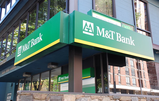
Montgomery County thinks urban...except when it comes to banks

M&T Bank in Downtown Silver Spring
Image Courtesy of Adam Fagen
This article one part of a multi-segment series titled The Urban Transformation, which takes a look at how certain public institutions and private businesses are adapting to nascent urban environments

Montgomery County, MD probably utilizes more new urbanist, smart growth principles in development planning than pretty much every other jurisdiction in the DC Metro region (outside of Washington D.C. itself), and more so than most suburban counties in the nation. However, while new walkable, transit-oriented urban centers in the county have been rapidly growing over the past decade or so with the construction of new high-density, mixed-use development built along these principles, it seems that one type of business has stubbornly resisted the urban transformation: bank branches.

The typical template for mixed-use development in Montgomery County's urban centers comprises either residential units or commercial office space (relatively rare in these days of high vacancy rates across the Metro area and limited government and business expansion) above ground-floor retail in mid- or high-rise buildings. When I use the term "retail" I'm encompassing a wide range of businesses such as: restaurants, nightclubs, barbers, supermarkets, pharmacies, bars, bank branches, etc. The combination of uses in these mixed-use developments is crucial to creating a true urban environment where residents can live, work, shop, and play, and the streets are active from dawn well into the night.

For some reason, banks (in Montgomery County's urban areas) have shied away from this type of development, while pretty much every other form of "retail" has embraced it. There are a number of new bank branches popping up in the county's urban areas, but many as traditional stand-alone single-story buildings with parking, rather than on the ground-floor of multi-story buildings. Some of these locations are pretty high-profile and on very valuable plots of land. 

Monday, November 4, 2013

Soaring to New Heights: The Growing Airports of the Mid-Atlantic

John F. Kennedy (JFK) International Airport in New York, NY
Image courtesy allairports.net
According to the FAA's report on the busiest airports in the US (by total passenger boardings) for 2012, eight of the 50 busiest airports in the nation are located in the Mid-Atlantic. Of these eight airports, three are in the New York metropolitan area, three are in the Baltimore-Washington metro area, one is in the Philadelphia metro area, and one is in the Pittsburgh metro area. The busiest American airport in 2012 was once again Atlanta's Hartsfield-Jackson International Airport with 45,798,809 enplanements. The busiest airport in the Mid-Atlantic (and 6th busiest nationally) was New York's John F. Kennedy International Airport.

Spotlight on BWI Airport: Rapidly expanding airport regains title of busiest airport in Balt-Wash Metro


In recent years Baltimore-Washington Thurgood Marshall Airport (BWI Airport), has been experiencing a renaissance of sorts. Built in 1947 in unincorporated Anne Arundel County, MD near Glen Burnieand originally named Friendship International Airport, it became the first airport in the region (and one of the first in the nation) with the ability to serve jet aircraft in 1957. In 1974, Friendship Airport (which is approximately equidistant from Washington D.C. as Dulles Airport) was renamed Baltimore/Washington International Airport to attract a greater share of the Washington D.C. air travel market. BWI Rail Station, which was dedicated on October 23, 1980, further increased the airport's connection to the Washington D.C. market and was the first intercity rail station in the U.S. built to service an airport.

Promotional shot of Friendship airport on opening day in 1947
Image courtesy of Kilduffs
In the following decades BWI grew to become a major domestic and international airport, as well as an important hub for Piedmont Airlines (and later it's successor USAir/US Airways) all the while maintaining its status as busiest airport in the region. BWI's legacy as a hub for low-fare airlines began in 1993 when Southwest Airlines selected BWI Airport as their East Coast gateway and has steadily expanded ever since. In 1997 the airport completed several major expansion projects including a parking garage expansion providing a total of 5,600 spaces and a $140 million international terminal which included a MTA Light Rail station serving a branch extension of the system. Four years later AirTran Airways launched service to Atlanta and Boston and proceeded to grow a hub that eventually saw 5,100 passengers a day to 29 non-stop destinations in 2011, when the airline merged with Southwest. In the same year BWI was named the fastest-growing of the 30 busiest airports in the nation.

Tuesday, August 6, 2013

Urbanizing America: The Mid-Atlantic

The Baltimore-Washington Metro Area from Space
(Washington D.C. at top of photo, Baltimore is below) 
Image Courtesy of NASA Johnson Space Center
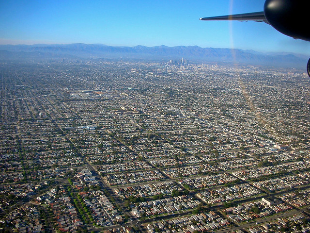
White Flight and Suburbanization
Suburban sprawl around Los Angeles
Image by flickr user ATIS547
While most metropolitan areas in the Mid-Atlantic continue to grow steadily, population growth within the metro areas themselves, in terms of cities vs suburbs, is uneven. From the 1950's up until the early 2000's population and economic growth in America has been strongest in its suburbs. There were a large number of catalysts for this growth shift out of urban areas, the most notable of which is the "white flight" phenomenon of white Americans leaving industrial cities for new housing in their suburbs. This in turn was precipitated by the “Great Migration” of economically disadvantaged African-Americans from the South (were racism was still prevalent and job opportunities scarce) to industrialized cities in the Northeast and Midwest between 1940 and 1970. As blacks moved into traditional white European-American neighborhoods, ethnic frictions served to accelerate flight into the suburbs because of lower property values and higher crime rates. 

Wednesday, July 24, 2013

The Growing Metropoltan Areas of the Mid-Atlantic

The Mid-Atlantic from Space
From upper L to R: 
Washington D.C., Baltimore, Philadelphia, and New York. 
(Richmond and Hampton Roads in VA are also partially visible at the far left and lower left parts of the photo respectively)
Image Courtesy of NASA Johnson Space Center
The  Northeast is one of the most populous and most densely populated regions in the United States. This past spring, the Census Bureau released its 2012 population estimates for the nation's metropolitan areas. The estimated population for the largest combined metropolitan areas (CSA's*) in the Northeast was 50,475,854, or approximately 16% of the U.S. population. The Mid-Atlantic accounts for a significant portion of that total, with a population of 39,823,114 in its three major combined metro areas (New York, Philadelphia, and Baltimore-Washington D.C.). A table with the 2012 populations of the largest individual metro areas (MSAs) in the region is posted after the break:

Thursday, February 28, 2013

Washington's Skyscrapers: The Tallest Buildings in the DC Metro Area

Updated 08/02/13

Washington D.C. is well-known for its uniform skyline of buildings all built up to around the same height, with the few exceptions being a handful of famous monuments and the U.S. Capitol. The main reason that DC (which currently has a population of over 600,000 residents), doesn't have a towering skyline  like other major cities such as New York or San Francisco is the Heights of Buildings Act of 1910

The 1910 Act is the most recent of a series of height restrictions, the first of which was put into law by D.C. Commissioners in 1894 in response to DC's first residential "skyscraper," the 14-story/164 ft. Cairo Hotel (now a condominium building known simply as "The Cairo"). The 1910 Act passed by Congress, which is still in force today, states that maximum height for buildings in DC is 90 feet (27 m) on residential streets, 130 feet (40 m) on commercial streets, and 160 feet (49 m) on a small portion of Pennsylvania Ave.
The Cairo, DC's first "skyscraper"
Over the past decade or so (most recently in 2012) there have been numerous attempts to remove or relax the city's height limit. However, there has also been some vocal opposition, particularly from historical preservationists, that skyscrapers would ruin views of the city's iconic monuments. In general, the District government is very supportive of the removal of height limits in order for it to maintain more control over development, and to maximize land usage in a city that is quickly running out of space to grow and where rent is among the highest in the nation. 

Some proposals have suggested removing the limits in only certain parts of the city, such as east of the Anacostia river. As a big fan of DC architecture I personally wouldn't mind seeing the height limits remaining in place. The uniform-height urban "canyons" that exist downtown on major roads such as K Street and Connecticut Ave are unique to this country and projects an image of orderliness that matches DC's status as the seat of the federal government. Paris also has similar height limits in place for most of the city.

Tuesday, February 26, 2013

Urban Maryland Development Map

Last summer I created a custom Google map of new high-density development projects (residential, retail, and commercial) in the Maryland side of the Washington Metropolitan Area. I used a smaller map, created by the Bethesda/Chevy Chase Regional Services Center for tracking development in Bethesda, as a template. The map is still incomplete, but after investing a ton of time in it I've managed to add locations/info on over 150 projects.

Included in the map are high-density developments (ranging from large scale multiple building mixed-use projects to single residential buildings) including mid-/high-rise buildings (5+ stories) completed since 2005,  under construction, or in planning stages. For each project there is a photo and description of the project. I'm a stickler for accuracy so to my knowledge all of the info is up-to-date and correct. 

My original plan was to cover all of the urban areas in Central MD from the DC suburbs to Baltimore (and maybe DC and Arlington Co./Alexandria), but with the rapid growth this area is experiencing (although it's currently threatened by a looming sequester) that quickly proved to be impractical. Currently the map includes all high-density projects in the following areas:

- Silver Spring (downtown)
- Bethesda (downtown)
- Friendship Heights/Village
- North Bethesda/White Flint
- Wheaton (downtown)
- Rockville (Twinbrook Area)
- Rockville (downtown)
- Rockville (office parks near Shady Grove Rd)
- other random projects

As I mentioned before, I probably won't be adding many more areas in the foreseeable future due to the amount of work involved (adding what I have currently took far longer than I expected it would). I would like to add certain projects in Gaithersburg and Germantown in Montgomery County, as well as College Park/Hyattsville/Riverdale Park, New Carrollton, and National Harbor in Prince George's County though. I will continue to constantly update projects already marked.


View Urban Maryland Development in a larger map